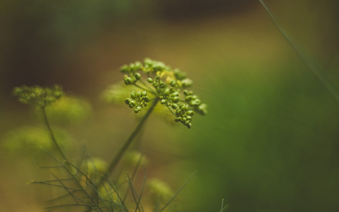
Google reports 13% emissions increase fueled by AI
The company is struggling to add carbon-free energy fast enough, CSO Kate Brandt told GreenBiz.
The company is struggling to add carbon-free energy fast enough, CSO Kate Brandt told GreenBiz.
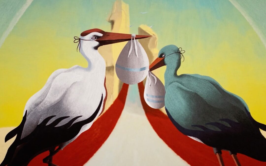
The timeless tale of the stork delivering babies is, like many myths, difficult to trace to a single source, as the story unfolds in folklore throughout Europe, the Americas, North Africa, and the Middle East. In the short film “Impossible Journey” —directed by YUCA and produced by The Youth Company and Colossal (no affiliation)—the creature’s vital mission sets the scene for a critical and poignant message.
When one determined stork takes off from the Tree of Life, we follow it and its precious cargo through heavy weather and around a spewing volcano before eventually landing inside a modern maternity ward. More
Do stories and artists like this matter to you? Become a Colossal Member today and support independent arts publishing for as little as $5 per month. The article Raising Awareness of Systemic Racism in Healthcare, a Stork Embarks on an ‘Impossible Journey’ appeared first on Colossal.
A new report has found that climate lawsuits being filed against companies are on the rise all over the world, and most of them have been successful. The report by the Grantham Research Institute on Climate Change and the Environment at the London School of Economics and Political Science (LSE) — Global trends in climate […]
The post Climate Lawsuits Against Polluting Companies Are Increasing Around the World, Report Finds appeared first on EcoWatch.
Mapping for a Sustainable Future: YouthMappers Tackle Global Climate Challenges
jschoshinski
Thu, 06/27/2024 – 19:05
Since 2015, the USAID GeoCenter has supported YouthMappers, a program that equips university students around the world to use geospatial technology to address local and global development challenges. Now young people from more than 400 universities across 77 countries participate in the YouthMappers network, using their skills to identify and respond to the needs of their communities and support broader mapping campaigns.
Provided with training in Geographic Information Systems (GIS), leadership, and professional development, YouthMappers collaborate with community organizations, governments, humanitarian partners, and local groups to inform decision making for sustainable development. While YouthMappers work across all development sectors, students have shown particular interest in conducting climate-related mapping activities.
Students and alumni of the YouthMappers network—including myself (Adele Birkenes, Geospatial Analyst at the USAID GeoCenter and co-founder/ former president of Vassar’s YouthMappers chapter)—have come of age at an “all hands on deck” moment regarding the climate crisis. We, as young people, have found identity, purpose, and camaraderie in our participation in the YouthMappers program because it enables us to apply our digital skills and university coursework to tangibly tackle the climate-related issues that impact our day-to-day lives. Join me for a low-carbon tour around the world as we learn about the climate adaptation and mitigation work of YouthMappers, with a specific focus on projects related to disaster risk reduction, forest health, and urban sustainability.
Preparing for the Next Disaster
Climate change is making extreme weather events more frequent and intense, exacerbating existing inequalities and disproportionately impacting vulnerable populations. YouthMappers in Bangladesh, Iraq, and Mexico are among the many chapters helping their communities better prepare for and respond to disasters.
The Haor region of Bangladesh is a large wetland ecosystem with cultural, biological, and economic significance that is being threatened by increased flooding. To help inform flood mitigation plans in the region, YouthMappers at Shahjalal University of Science and Technology created a risk distribution map of Sunamganj District. Over a period of two days, a group of 15 dedicated students traveled by boat, car, and rickshaw to collect data on rainfall, land use, land cover, and other topographical information. They then used geospatial technology to develop a comprehensive map highlighting potential flood hazards.
More frequent and severe flooding is also impacting Iraq, including the city of Erbil. YouthMappers at Erbil Polytechnic University organized a workshop with local government authorities, scientists, and community leaders to share their insights on flood mapping, risk assessment, and mitigation strategies. The workshop provided valuable data for local authorities and empowered the community with knowledge and resources to better respond to flooding events.
In October 2023, Hurricane Otis quickly—and unexpectedly—became the strongest Pacific landfalling hurricane on record in Mexico; the affected communities near Acapulco did not have access to the technology needed to anticipate its magnitude and adequately prepare for its impacts. Economically disadvantaged coastal neighborhoods where homes were mostly self-built experienced worse impacts than formal urban settlements. To help decision makers quickly assess the damage to coordinate response efforts, YouthMappers across the country coordinated a Mapathon to generate a base layer map in just 19 days, with nearly 1,000 strategic infrastructure sites completely mapped within one month.
Image
YouthMappers at Woldia University in Ethiopia.
Photo Credit: Tadesse Getachew
Conserving Forests
Forests help capture carbon and provide other ecosystem services critical to human well-being and resilience. YouthMappers in Bolivia, Malawi, and Uganda are mapping these valuable ecosystems to help protect them. Ultimately, GIS is providing decision makers and community members the information they need to improve forest management.
Bolivia is home to several ecologically and geologically significant destinations, including Senda Verde Wildlife Sanctuary. YouthMappers at the Universidad Mayor de San Andrés embarked on a three-day data collection excursion to develop thematic maps in support of sustainable tourism planning for the sanctuary.
YouthMappers in Malawi also were determined to demonstrate the value of their country’s forests, particularly Dzalanyama Forest Reserve, where deforestation is exacerbating the impacts of climate change on local communities’ health, food security, and livelihoods. Members of the Malawi University of Science and Technology (MUST) YouthMappers chapter used their GIS mapping skills to visualize the extent and pace of deforestation in the Dzalanyama Forest Reserve, with the hope of sparking important conversations about the impacts of climate change in the region.
Uganda’s Budongo Central Forest Reserve faces similar challenges. Geo YouthMappers at Makerere University used remote sensing and other digital technologies to identify deforestation “hotspots” in the area and uncover the drivers of deforestation. Scientists can use this data to help communities more effectively monitor and sustainably manage the land.
Image
YouthMappers at Eastern University in Bangladesh collect data in informal settlements to support community resilience.
Photo Credit: Brazil Singh
Promoting Sustainable Cities
Cities face adverse impacts of climate change, but they also play an important role in meeting immediate climate targets and achieving long-term transformative change. YouthMappers chapters in Zambia and Colombia are providing the data to help them do just that.
Buses are an important mode of transportation in Lusaka, Zambia. YouthMappers at the University of Zambia are mapping the cities’ bus routes to help the Government of Zambia assess their daily carbon emissions. The YouthMappers, together with the Lusaka City Council, Zambian Ministry of Health, and Zambia Road Traffic and Safety Agency, are using this information to encourage people to walk or ride bicycles where carbon emissions from buses are most pervasive.
The campus of the Universidad Nacional de Colombia, Medellín (National University of Colombia, Medellín) is a critical hub of biodiversity in the middle of the city, but not everyone who studies, lives, and works in the area is aware of its importance. The university’s local YouthMappers chapter, SAGEMA UN Medellín, undertook a comprehensive mapping of the campus arboretum and botanical garden to help raise awareness of this biodiversity and show the community why conserving the forests of Colombia is key to confronting climate change.
“It’s not just about trees; it’s our small yet impactful step in fighting climate change and preserving biodiversity…[E]very tree on the map tells a unique story in the global narrative of environmental change.” – YouthMappers, National University of Colombia, Medellín chapter
As you can see from this global tour, YouthMappers are applying their geospatial skills to understand the impacts of climate change. They are demonstrating the power of young people to mobilize and directly address climate priorities in their communities and countries. To learn more, please check out the YouthMappers blog, the open access book Open Mapping towards Sustainable Development Goals: Voices of YouthMappers on Community Engaged Scholarship, and the documentary “The Power of YouthMappers: Shining a Light on the Movement.”
Teaser Text
Young people from more than 400 universities across 77 countries participate in the YouthMappers network to identify and respond to the needs of their communities.
Publish Date
Thu, 06/27/2024 – 12:00
Author(s)
Adele Birkenes
Lindsey Larsen
Hero Image
University of Dar es Salaam YouthMappers, Tanzania – Monitoring Afforestation Project – YouthMappers and Local Community taking GEO POINTS and filling in the survey of the planted trees using Kobo colle.jpg
Blog Type
Blog Post
Strategic Objective
Adaptation
Integration
Mitigation
Region
Global
Topic
Adaptation
Biodiversity Conservation
Emissions
Climate Change Integration
Climate Risk Management
Digital technology
Food Security
Indigenous Peoples and Local Communities
Land Use
Locally-Led Development
Mitigation
Partnership
Resilience
Urban
Green Cities
Youth
Country
Ethiopia
Mexico
Bangladesh
Colombia
Malawi
Uganda
Zambia
Iraq
Bolivia
Sectors
Gender and Social Inclusion
Show Download Link
Off
Yarra Valley Water has launched its new Community Grants Program to support local groups that help build thriving and sustainable communities. Applications are open now, and close at 5 pm on Sunday, 14 July 2024.
Not-for-profit organisations based in Yarra Valley Water’s service area, or those that provide services in the area, are eligible to apply.
Grants of up to $15,000 are available for larger initiatives, and up to $5000 for smaller projects.
This initiative aims to support projects that save water, educate communities on efficient water usage, improve habitats and strengthen community connections.
Pat McCafferty, Yarra Valley Water Managing Director, said: “We’re looking for community organisations and education bodies who share our vision of driving a sustainable water future.
“There are many charities, community groups and not-for-profit organisations doing incredible work. By supporting these groups, we ensure they can continue to have a positive impact on the communities they serve.”
Examples of eligible projects include the installation of water tanks, efficient irrigation systems, community gardens and habitat restoration. Projects could also include the purchase of water-saving dishwashers, washing machines and efficient showers. Community groups such as sports clubs, community kitchens, schools or animal shelters in Yarra Valley Water’s service area are encouraged to apply for funding to support projects that:
help communities thrive through education and connection
improve water efficiency and conservation
boost community water awareness
promote sustainable water use
improve habitats and care for the natural ecosystem.
For more information and to apply for a community grant, click here.
Image credit: Yarra Valley Water.