Search

Google’s groundbreaking satellite now orbits Earth to spot fires faster than ever before

We are an online community created around a smart and easy to access information hub which is focused on providing proven global and local insights about sustainability

21 Mar, 2025

This post was originally published on Sustainability Times

Source: Sustainability Times

IN A NUTSHELL
  • 🔥 FireSat is a revolutionary satellite constellation designed to detect wildfires with high precision and speed.
  • The project is led by the Earth Fire Alliance, including major partners like Google and Muon Space.
  • Advanced AI algorithms enhance detection and prediction capabilities, aiding firefighters in controlling flames effectively.
  • 🌍 By 2030, over 50 satellites will provide global coverage, aiming to reduce the economic and environmental impacts of wildfires.

As wildfires become increasingly frequent and devastating, new technologies are emerging to help combat this global challenge. A groundbreaking development in this arena is the launch of the FireSat constellation, a series of satellites specifically designed to detect wildfires early and accurately. This initiative, spearheaded by the Earth Fire Alliance, promises to revolutionize how we identify and respond to these natural disasters, potentially saving lives and minimizing damage.

FireSat: A Game-Changing Initiative

The FireSat constellation is a monumental step forward in wildfire detection. Unlike current satellite systems that rely on low-resolution images and can only survey an area twice a day, FireSat’s capabilities are vastly superior. It uses high-resolution multispectral infrared cameras to monitor wildfires as small as 270 square feet. These cameras are designed to capture imagery that can be analyzed by machine learning algorithms, distinguishing real fires from misleading objects like smokestacks.

Les feux de forêt peuvent se déclarer plus rapidement que les systèmes actuels ne peuvent les détecter – et causer des dommages considérables s’ils ne sont pas maîtrisés rapidement après leur déclenchement.

This innovative approach allows the system to provide updates every 20 minutes, significantly enhancing the speed and precision of wildfire detection. As a result, FireSat can play a crucial role in early intervention, potentially preventing the extensive destruction of natural habitats and urban areas. The technology’s ability to predict the spread of fires further empowers firefighters to make informed decisions, improving safety and effectiveness in crisis management.

Water appeared just 100 million years post-Big Bang—A mind-bending rewrite of cosmic history

The Earth Fire Alliance and Its Vision

The Earth Fire Alliance, a nonprofit organization, is the driving force behind FireSat. This collaboration includes major players like Google and the space services startup Muon Space. Their collective vision is to create a comprehensive system capable of monitoring wildfires globally, thereby mitigating the catastrophic effects these disasters have on communities and ecosystems.

By 2030, more than 50 satellites are expected to be operational, forming a robust network that will offer unparalleled coverage and accuracy. This ambitious project has been in development for less than 18 months, yet it holds the potential to transform our approach to wildfire management. The initiative underscores the power of collaboration between technology giants and innovative startups in addressing some of the world’s most pressing environmental challenges.

Declining Food Enjoyment in the U.S. and Its Impact on Health

Technological Advancements in Satellite Imagery

The success of FireSat hinges on its advanced technological components, particularly its multispectral infrared cameras. These cameras are equipped to capture detailed images across six spectral bands, providing a rich dataset for analysis. The use of artificial intelligence (AI) in processing this data is a key factor in the system’s effectiveness.
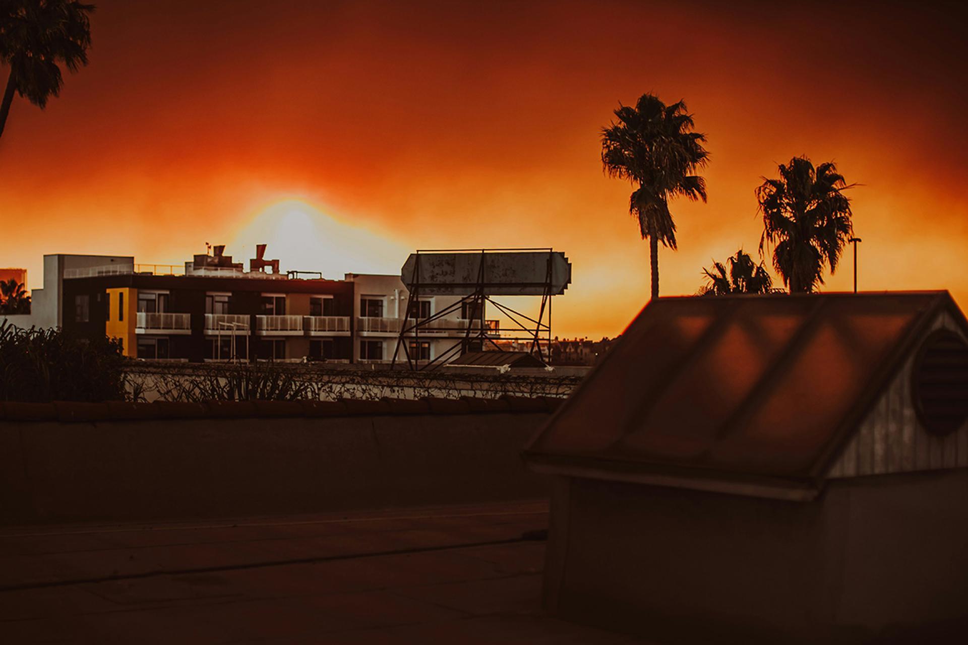
Les incendies qui ont ravagé Los Angeles en janvier sont estimés avoir causé plus de 250 milliards de dollars de dégâts.

The AI algorithms employed by FireSat analyze images by comparing them with historical data, identifying anomalies that indicate the presence of wildfires. This capability not only improves detection accuracy but also aids in predicting fire behavior. Such insights are invaluable for emergency responders, who can leverage this information to strategize and deploy resources more efficiently, ultimately reducing the impact of wildfires on human lives and property.

Electric rough terrain forklifts: an eco-friendly solution for industries pursuing sustainability

Economic and Environmental Impacts

Wildfires are not just environmental disasters; they also have significant economic repercussions. The wildfires in Los Angeles earlier this year serve as a stark reminder, with damages exceeding $250 billion. The financial burden extends beyond immediate damages, affecting insurance costs, healthcare, and economic productivity.

FireSat’s ability to detect and respond to wildfires promptly can mitigate these economic impacts. By preventing fires from escalating, the system can reduce recovery costs and preserve vital infrastructure. Furthermore, protecting forested areas helps maintain biodiversity and ecosystem services, which are crucial for environmental stability and resilience against climate change.

Aspect Current Systems FireSat
Detection Area Large (acres) Small (270 sq ft)
Update Frequency 12 hours 20 minutes
Technological Basis Low-resolution High-resolution with AI

The launch of FireSat marks a significant advancement in our ability to manage wildfires effectively. As these satellites begin to orbit, we have an unprecedented opportunity to minimize the destructive impact of wildfires, protecting both human lives and the environment. How will this innovative approach shape the future of disaster management and environmental conservation?

The post Google’s groundbreaking satellite now orbits Earth to spot fires faster than ever before appeared first on Sustainability Times.

Pass over the stars to rate this post. Your opinion is always welcome.
[Total: 0 Average: 0]

You may also like…

‘The Science Is What Sets Us Apart’: How the Rodale Institute Has Spent 77 Years Innovating Regenerative Organic Agriculture

‘The Science Is What Sets Us Apart’: How the Rodale Institute Has Spent 77 Years Innovating Regenerative Organic Agriculture

Founded in 1947 by J.I. Rodale, Rodale Institute is a nonprofit dedicated to helping the regenerative organic agriculture movement grow through research, education and farmer training. In his study of regenerative organic farming, Rodale — who came up with the term “organic” — studied Indigenous agricultural practices, including those of communities like the long-lived Hunza […]
The post ‘The Science Is What Sets Us Apart’: How the Rodale Institute Has Spent 77 Years Innovating Regenerative Organic Agriculture appeared first on EcoWatch.

Urban 'placemaking' focus for $85m recreation centre

Urban 'placemaking' focus for $85m recreation centre

Sydney developer Billbergia Group has announced the Rhodes Recreation Centre — an $85 million, 9200 m2 multi-purpose community hub in Sydney’s Inner West.

Located at 6 Gauthorpe St and designed by architectural firm SJB, the recreation centre is in a three-level podium building beneath two high-rise residential towers — the 48-level Peake and 43-level Oasis. Together, they form stage two of the developer’s Rhodes Central Masterplan — a $3 billion, three-stage town centre project.

The Rhodes Recreation Centre was delivered under a $97 million Voluntary Planning Agreement (VPA) between the developer and City of Canada Bay Council. It will be handed over to council next month and is set to open later this year. Once complete, the masterplan will have delivered 25,000 m2 of dedicated public amenity, including retail, community facilities and open space.

With the NSW Government’s housing reforms set to address the housing shortage, the recreation centre will reflect the importance of ‘placemaking’ — a collaborative approach to designing and managing public spaces that enhances community wellbeing and fosters connections between people and their environment — in planning new urban communities.

It also presents a pathway for public and private sectors to collaborate and create social infrastructure while increasing housing supply in fast-growing suburbs.

The recreation centre is set to add vibrancy and pedestrian activity to the local streetscape, providing a diverse range of facilities that enhance the livability of the evolving suburb. These community amenities include two full-sized indoor sports courts, a gymnastics centre, a 70-place childcare centre, a community lounge, allied health services, and bookable spaces for local groups and events. It also provides a gym with cardio equipment, weights, group fitness rooms, a creche and an outdoor terrace, alongside a range of sustainability features.

Facilities at the Rhodes Recreation Centre. Images supplied.

“Rhodes Recreation Centre is the community heart of our high-density TOD development, bringing to life Billbergia’s vision for a future-focused, livable urban environment that prioritises amenity, not just density,” said Saul Moran, Development Director – Planning and Design at Billbergia.

The amenities within the two residential towers include a swimming pool, spa, sauna, children’s play area, library and theatre rooms. Pedestrian connections and through-site links provide access to Rhodes railway station and the Homebush Bay waterfront.

“The Rhodes Recreation Centre stands as a benchmark in successful public–private collaboration. Through a VPA with Canada Bay Council, we’ve created a pathway to unlock additional housing supply while delivering significant, lasting community infrastructure. It’s a clear demonstration of how thoughtful public and private partnerships can shape vibrant, livable neighbourhoods,” Moran said.

Located adjacent to Rhodes railway station, stage one of Billbergia’s Rhodes Central Masterplan was completed in 2021 and included the 13,000 m2 Rhodes Central Shopping Centre, with convenience retail, a Woolworths supermarket, medical facilities and the Bamboo Lane dining precinct.

Other previous projects include the 1.2 ha Phoenix Park in Rhodes, the $63 million Bennelong Bridge, the popular Baylink Shuttle service, the 3500 m2 Wentworth Point Community Centre and Library, and the Wentworth Point Pop-Up Town Square.

Billbergia’s ongoing focus on placemaking and social infrastructure also includes the $8.4 million delivery of a library at its mixed-tenure development, Arncliffe Central, in Sydney’s south. There is the potential for 75% of Arncliffe Central’s dwellings to be dedicated to social, affordable and essential worker rental housing, along with 3400 m2 allocated to childcare, convenience retail and cafes, and a 4000 m2 park with play space for both residents and the broader community.

Top image caption: The Rhodes Recreation Centre location with two planned residential towers, Peake and Oasis. Image supplied.

Environmental Groups Successfully Petition Alabama to Update Water Toxicity Standards

Environmental Groups Successfully Petition Alabama to Update Water Toxicity Standards

A group of seven conservation organizations has successfully petitioned the Alabama Environmental Management Commission (AEMC) to update the Alabama Department of Environmental Management’s (ADEM) water toxicity standards for 12 pollutants. In April, the group filed a Petition for Rulemaking that argued that the existing water toxicity standards in Alabama did not properly protect public health, […]
The post Environmental Groups Successfully Petition Alabama to Update Water Toxicity Standards appeared first on EcoWatch.

0 Comments