This post was originally published on Eco Watch
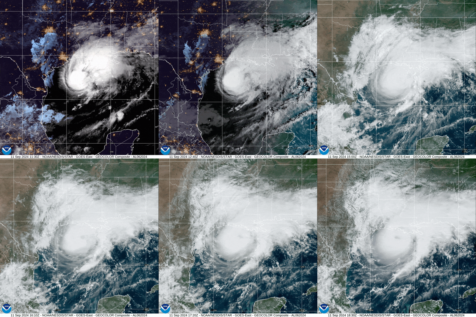
Tropical Storm Francine strengthened into a Category 1 hurricane as it moved through the Gulf of Mexico Tuesday night, with maximum sustained winds of 85 miles per hour and gusts of up to 101 mph recorded by an oil platform Wednesday morning, the National Hurricane Center said.
The storm prompted Louisiana residents to move inland, and oil and gas companies to stop a quarter of their production, according to the United States Bureau of Safety and Environmental Enforcement, as Reuters reported. Mandatory evacuation orders were issued for several areas.
The hurricane center said hurricane-force winds and life-threatening storm surge were expected to begin this afternoon.
“Outer rainbands are starting to move onshore of the coast of southern Louisiana. These conditions will continue to deteriorate over the next couple of hours. Ensure you are in a safe location before the onset of strong winds or possible flooding,” the National Hurricane Center said.
Storm surge warnings or watches were in effect for the Mississippi, Louisiana and Alabama coastlines, with Hurricane Francine posing a threat to the broader Gulf Coast up to the Florida-Alabama border, Reuters reported.
“The storm has been picking up the pace as it moves toward us from the southwest, and not only is the wind getting stronger here, its outer rain bands have just arrived,” CNN meteorologist Derek van Dam reported early Wednesday afternoon from Morgan City, Louisiana. “It’s the first sprinkle of what could be a lot of rain – as much as 10 inches is expected in parts of southern Louisiana.”
The National Weather Service (NWS) warned Francine was expected to gain enough strength to become a Category 2 hurricane by the time it made landfall.
“Hurricane Francine will be making landfall later today!” NWS said on X. “Make sure you have all preparations rushed to completion ASAP! Then, prepare to hunker down & shelter in place through the overnight hours.”
A Bayaks County Store clerk in Cameron Parish on the Louisiana coast said that, while the shop was open Wednesday morning for anyone needing last-minute supplies, no one had come in, reported Reuters.
“The store is open, but we have no customers. Everyone ran out of town,” the clerk said.
Morgan City Police Chief Chad Adams told media that a curfew had been set from Wednesday at 11 a.m. until Thursday at 6 a.m. to encourage people to stay put.
A federal state of emergency was declared by President Joe Biden, in addition to a state of emergency set by Louisiana Governor Jeff Landry, to expedite necessary rescue or relief efforts.
The National Hurricane Center predicted Hurricane Francine would top out at Category 2 strength — with maximum sustained winds from 96 to 110 mph — before weakening as it made landfall and moved north.
NWS said the hurricane was expected to bring four to eight inches of rain, with local accumulations as high as a foot through Thursday night in the central and eastern portions of the Gulf Coast.
The post Hurricane Francine Reaches Louisiana, Bringing Strong Winds and Heavy Rain to Wider Gulf Coast appeared first on EcoWatch.


0 Comments